
ED
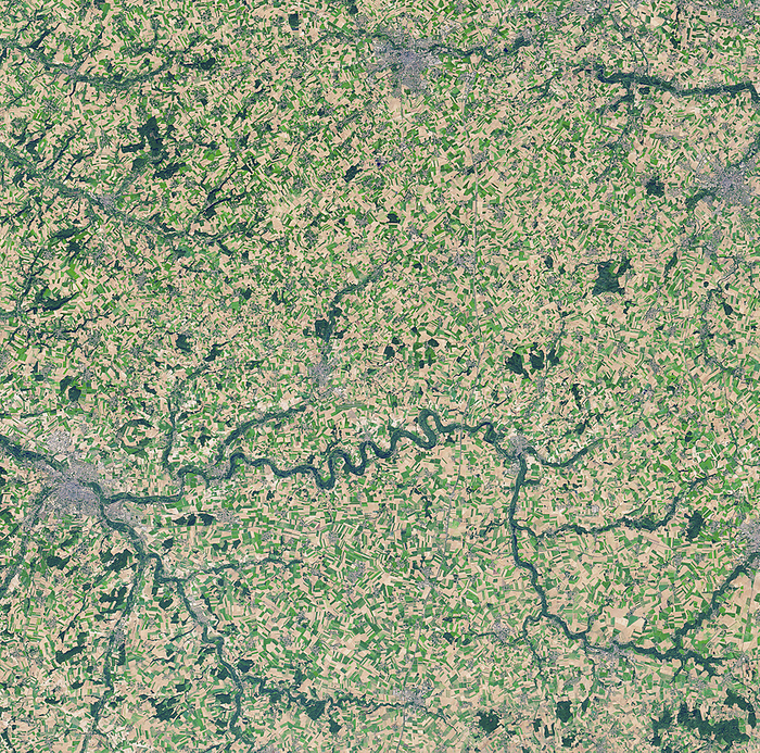
Somme River and WWI battlefields, satellite image
Somme River and WWI battlefields, satellite image. North is at top. The Somme River and battlefields are at centre near Albert. At left is the city of Amiens, with Arras at top centre and Cambrai at upper right. Between July and November 1916, the British and French armies fought German armies here in the First World War's Battle of the Somme. With more than a million casualties, it was one of the bloodiest battles in history. This image shows part of the area around the Somme and Ancre rivers where the battles took place. It has been 100 years since the end of the war, but still present are the remains of trenches and large craters from the detonation of underground explosives. This image is around 60 kilometres across. It was obtained on 21 October 2018, with the Operational Land Imager (OLI) on Landsat 8.
Details
ID
122231487
Collection
License type
Editorial
Photographer
Creation date
13-02-2020
Contact Aflo for all commercial uses.

More
Top Categories