
ED
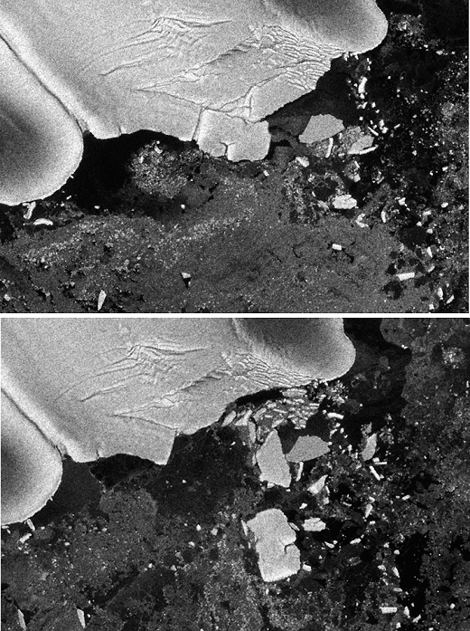
Great East Japan Tsunami Collapsing a Corner of the Antarctic Iceberg (Satellite image provided by NASA)
The top image, acquired by the Advanced Synthetic Aperture Radar on the European Space Agency's Envisat satellite on March 11, 2011, shows The top image acquired by the Advanced Synthetic Aperture Radar on the European Space Agency's Envisat satellite on March 11, 2011, shows just before the icebergs began to separate from the Sulzberger Ice Shelf along the Antarctic coast, while the bottom image shows the chunks of ice well out to sea five days later as a result of the March 2011 tsunami When the Tohoku earthquake and tsunami occurred off the Antarctic coast, the icebergs began to separate from the Sulzberger Ice Shelf along the Antarctic coast, while the bottom image shows the chunks of ice well out to sea five days later as a result of the March 2011 tsunami half a world away in Japan.
When the Tohoku earthquake and tsunami occurred off Japan on March 11, 2011, within 18 hours, the waves had traveled 13,600 kilometers and reached the The swell from the Tohoku tsunami was likely only 30 cm when it reached the Sulzberger Ice Shelf, but the consistency of the waves created enough stress to cause the calving. (Photo by NASA/AFLO) [3133].
Details
ID
13928965
Collection
License type
Editorial
Photographer
Creation date
09-08-2011
Contact Aflo for all commercial uses.

More
Top Categories