
ED
Aral Sea (1973)
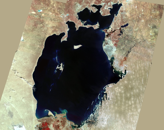
Aral Sea, satellite image. Image 1 of 4. North is at top. This inland lake is found between Uzbekistan (west) and Kazakhstan (east) and used to be the fourth largest lake in the world. Since the 1960s, it has lost more than half of its volume. This is due to overuse of the feeder rivers (the Syr Darya and Amu Darya) in irrigation of cotton and paddy fields. Image obtained in 1973 using the Landsat 1 satellite. For a series showing the lake's progressive shrinkage, see images C003/2109 - C003/2112.
Details
ID
15534742
Collection
License type
Editorial
Photographer
Creation date
11-06-2012
Contact Aflo for all commercial uses.

More
Top Categories