
RM
Europa Island, satellite image
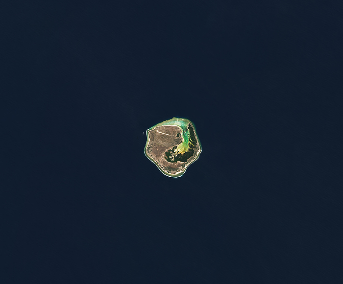
Satellite image of Europa Island, part of a French territory between Madagascar and Mozambique in the Mozambique channel, Indian Ocean. It spans about 28 square kilometres and is uninhabited except for the French military and scientists. An airstrip is visible (top of island), as is the Grand Lagoon (bright blue intersecting island), home to a large sea turtle population. Image acquired with the Operational Land Imager-2 (OLI-2) on Landsat 9, on April 3 2022., by NASA, Lauren Dauphin/SCIENCE PHOTO LIBRARY

More
Top Categories