
RM
Supercell thunderstorm, Nebraska, USA
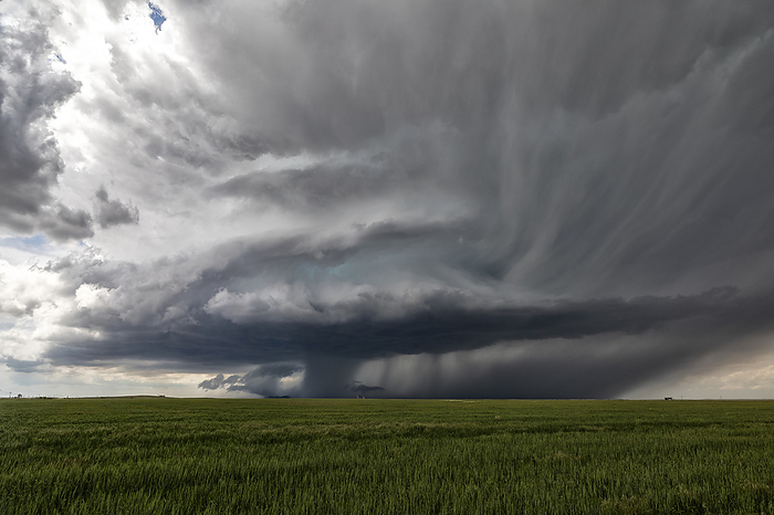
Supercell thunderstorm over fields near Oshkosh, Nebraska, USA. A supercell thunderstorm is a severe long-lived storm within which the wind speed and direction changes with height. This produces a strong rotating updraft of warm air, known as a mesocyclone, and a separate downdraft of cold air. Tornadoes may form in the mesocyclone, in which case the storm is classified as a tornadic supercell thunderstorm. The storms also produce torrential rain and hail. Photographed on 7th June 2022., by ROGER HILL/SCIENCE PHOTO LIBRARY

More
Top Categories