
RM
Ambresbury Banks, UK, 3D LiDAR scan
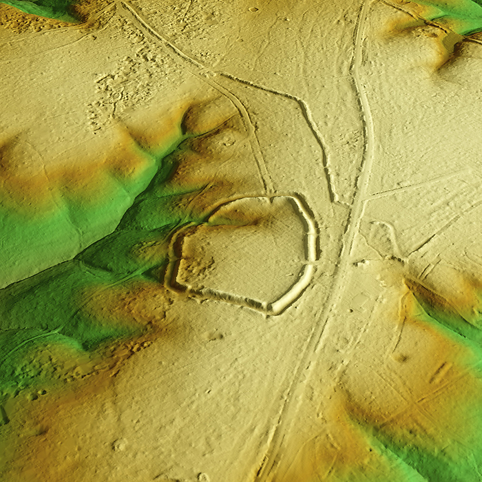
3D LiDAR scan of Ambresbury Banks in Essex, UK. The digital terrain model offers a view of the surrounding landscape without obstruction from foliage. This ancient hillfort dates back to the Iron Age, roughly between 700 BCE and 42 CE. It is believed to have been occupied and used for defensive purposes. Image contains UK public sector information licensed under the Open Government Licence v3.0., by SIMON TERREY/SCIENCE PHOTO LIBRARY

More
Top Categories