
RM
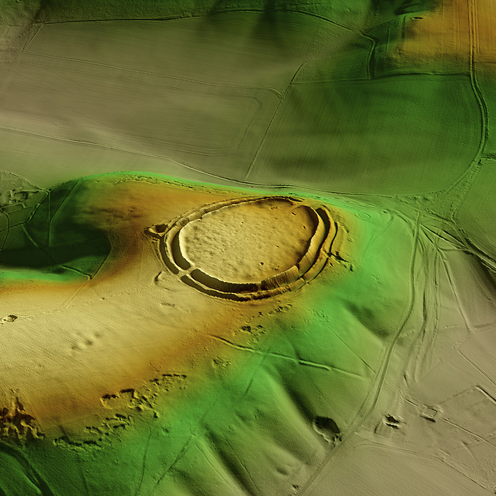
Barbury Castle, UK, 3D LiDAR scan
3D LiDAR scan of Barbury Castle in Wiltshire, UK. The digital terrain model offers a view of the surrounding landscape without obstruction from foliage. This ancient hillfort dates back to the Iron Age, roughly 2500 years ago. It is believed to have been occupied and used for defensive purposes. Image contains UK public sector information licensed under the Open Government Licence v3.0., by SIMON TERREY/SCIENCE PHOTO LIBRARY

More
Top Categories