
RM
Berth Hill, UK, 3D LiDAR scan
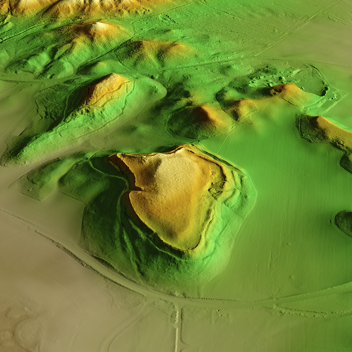
3D LiDAR scan of Berth Hill in Staffordshire, UK. The digital terrain model offers a view of the surrounding landscape without obstruction from foliage. This ancient hillfort is one of many hillforts found across the UK and dates back to the Iron Age, roughly between 800 BCE and 43 CE. Image contains UK public sector information licensed under the Open Government Licence v3.0., by SIMON TERREY/SCIENCE PHOTO LIBRARY

More
Top Categories