
RM
Badbury Rings, UK, 3D LiDAR scan
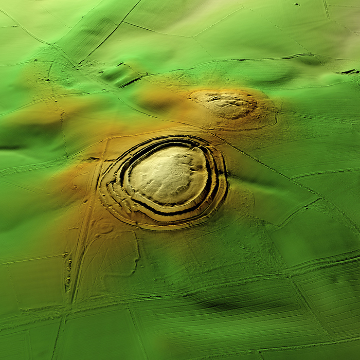
3D LiDAR scan of Badbury Rings in Dorset, UK. This digital terrain model reveals the site hidden by foliage and the disrupted pattern of the landscape. The hillfort lies within fields but has access via a carpark to the west. Bradbury Rings dates back to the Iron Age, with evidence suggesting that it was constructed around 800 BCE and was occupied until the Roman occupation of Britain. Similar hillforts can be found across the British Isles, which were used for defensive purposes and as centres of community life. Image contains UK public sector information licensed under the Open Government Licence v3.0., by SIMON TERREY/SCIENCE PHOTO LIBRARY

More
Top Categories