
RM
Forden Gaer, Wales, 3D LiDAR scan
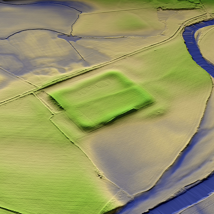
3D LiDAR model of Forden Gaer a Roman fort in Powys, Wales. The digital terrain model offers a view of the surrounding landscape without obstruction from foliage. The Roman settlement was established in the mid-1st century CE and was focused on a large earthwork enclosure. The fort was strategically built on the old Roman Road, which runs between Wroxeter and Caersws, and crosses the River Severn. Image contains UK public sector information licensed under the Open Government Licence v3.0., by SIMON TERREY/SCIENCE PHOTO LIBRARY

More
Top Categories