
RM
Hambledon Hill, UK, 3D LiDAR scan
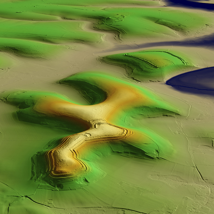
3D LiDAR model of Hambledon Hill, an Iron Age hillfort in Dorset, UK. The digital terrain model offers a view of the surrounding landscape without obstruction from foliage. Hillforts were settlements constructed on natural hills, typically fortified with earthworks around the contours of the hill. They were widely constructed across Britain and Ireland in the centuries preceding the Roman conquest of the regions. Hambledon hilltop is encircled by an Iron Age earthwork and there are extensive Neolithic features, making it a major archaeological site. Image contains UK public sector information licensed under the Open Government Licence v3.0., by SIMON TERREY/SCIENCE PHOTO LIBRARY

More
Top Categories