
RM
Oldbury Camp, UK, 3D LiDAR scan
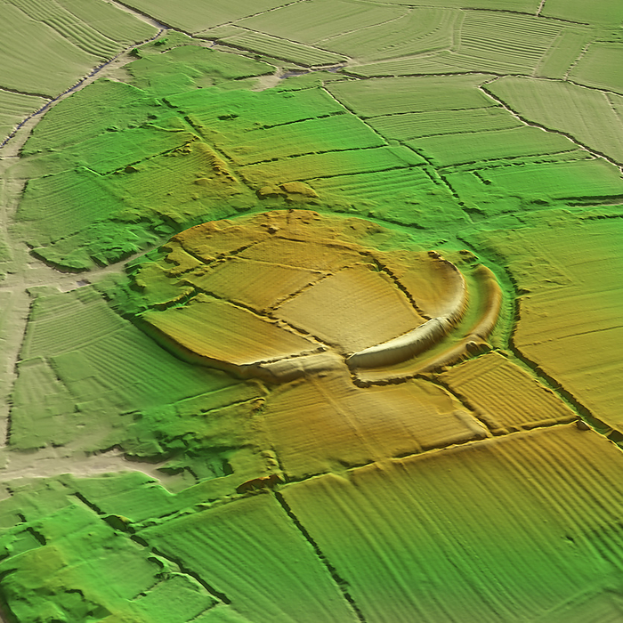
3D LiDAR model of Oldbury Camp, an Iron Age hillfort in Gloucestershire, UK. The digital terrain model offers a view of the surrounding landscape without obstruction from foliage. Hillforts were settlements built on natural hills, fortified with earthworks around the hill's contours. These were widely constructed across Britain and Ireland in the centuries leading up to the Roman conquest of these regions. Oldbury Camp was built into the hill around about 100 BCE. It covers an area of around 500,000 square metres and includes over 3 kilometres of ramparts. Image contains UK public sector information licensed under the Open Government Licence v3.0., by SIMON TERREY/SCIENCE PHOTO LIBRARY

More
Top Categories