
RM
Richborough Castle, UK, 3D LiDAR scan
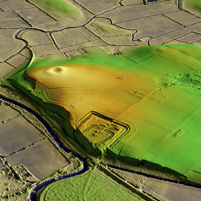
3D LiDAR model of Richborough Castle, a Roman fort in Kent, UK. The digital terrain model offers a view of the surrounding landscape without obstruction from foliage. Extensive remains of the massive fort walls still stand to a height of several metres. It is part of a larger Roman town called Rutupiae or Portus Ritupis that developed around the fort and the associated port. The settlement was established after Roman conquest of Britain in 43 CE. Image contains UK public sector information licensed under the Open Government Licence v3.0., by SIMON TERREY/SCIENCE PHOTO LIBRARY

More
Top Categories