
RM
Risbury Camp, UK, 3D LiDAR scan
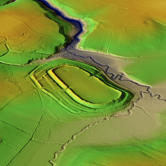
3D LiDAR model of Risbury Camp, an Iron Age hillfort in Herefordshire, UK. The digital terrain model offers a view of the surrounding landscape without obstruction from foliage. Hillforts were settlements constructed on natural hills, typically fortified with earthworks around the contours of the hill. They were widely constructed across Britain and Ireland in the centuries preceding the Roman conquest of the regions. Risbury Camp consists of a flat topped knoll, the levelling may be partly artificial. Its defences follow natural contours, with two ramparts. Image contains UK public sector information licensed under the Open Government Licence v3.0., by SIMON TERREY/SCIENCE PHOTO LIBRARY

More
Top Categories