
RM
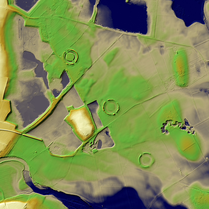
Thornborough Henges, UK, 3D LiDAR scan
The digital terrain model offers a view of the surrounding landscape without obstruction from foliage. This is a unique cluster of Neolithic monuments that lies on a raised plateau above the river Ure. The three huge circular henges -sometimes described as the 'Stonehenge of the North'-were built here about 4,500 years ago over an earlier The site includes many large ancient structures including a cursus, henges, burial grounds and settlements. information licensed under the Open Government Licence v3.0., by SIMON TERREY/SCIENCE PHOTO LIBRARY

More
Top Categories