
RM
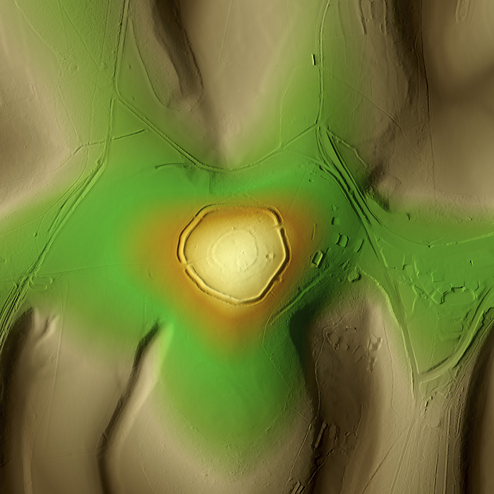
The Trundle, UK, 3D LiDAR scan
3D LiDAR scan of The Trundle, an Iron Age hillfort in Chichester, UK. The digital terrain model offers a view of the surrounding landscape without obstruction from foliage. This ancient hillfort is one of many found across the UK and dates back to the Iron Age, roughly between 700 BC and 43 AD. These hillforts served as fortified settlements or defensive structures for ancient communities, offering protection and strategic control over the surrounding territory. The Trundle is built on the site of a causewayed enclosure, a form of early Neolithic earthwork found in northwestern Europe. Image contains UK public sector information licensed under the Open Government Licence v3.0., by SIMON TERREY/SCIENCE PHOTO LIBRARY

More
Top Categories