
RM
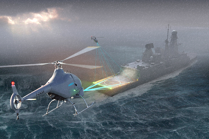
DeckFinder positioning system, illustration
Illustration of DeckFinder, a local positioning system developed by Airbus to help pilots land safely. When landing on small or moving helidecks, a difference of a few centimetres can compromise and endanger a whole mission. DeckFinder allows both manned and remotely piloted aerial vehicles (RPAS) to determine their position, even in harsh environmental conditions. This system enables fully automatic take-offs and landings, ensuring the safety of the mission., by AIRBUS DEFENCE AND SPACE / SCIENCE PHOTO LIBRARY

More
Top Categories