
RM
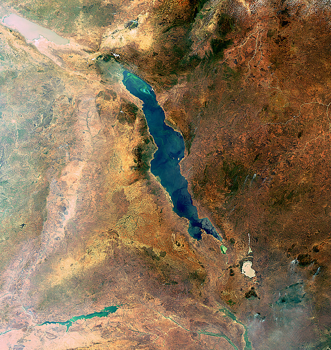
Lake Malawi, satellite image
Satellite image of Lake Malawi. Lake Malawi is an ancient lake, meaning it has contained water for over 1 million years. It is around 30,000 square kilometres in area and reaches depths of around 750 metres. It contains the most species of fish of any lake in the world, at over 800. The surrounding land includes Malawi (southwest), Zambia (west), Tanzania (upper right) and Mozambique (lower right). This image was captured by Envisat’s Medium Resolution Imaging Spectrometer (MERIS) on 12 October 2010., by EUROPEAN SPACE AGENCY/SCIENCE PHOTO LIBRARY

More
Top Categories